
Weber County ZIP Codes and Coverage
Utah’s official ZIP table lists Weber County place rows, but it does not draw delivery polygons or prove a municipal boundary. The rows below preserve the state’s labels. USPS remains the final source for a particular street address, ZIP, or ZIP+4.
| ZIP Code | Areas Covered | Post Office | Notes |
|---|---|---|---|
| 84310 | Eden | Verify by complete address | Place label only |
| 84056 | Hill AFB | Verify by complete address | Special place label |
| 84315 | Hooper | Verify by complete address | Place label is not a city map |
| 84317 | Huntsville | Verify by complete address | Valley-area place label |
| 84067 | Roy | Verify by complete address | City label may differ from tax jurisdiction |
| 84201, 84244 | Ogden | Verify by complete address | Special Ogden-labeled entries |
| 84401, 84402, 84403, 84404, 84405, 84407, 84408, 84409, 84412, 84414, 84415 | Ogden-labeled delivery areas | Verify by complete address | State table does not name every station |
Hill AFB and the two special Ogden rows deserve extra care. The state list also includes Eden, Huntsville, Hooper, and Roy, yet a place label is not evidence that every address falls inside that municipality. The table does not identify a dedicated post office or station for each row.
The Utah ZIP data table is the source behind this county ZIP capture.
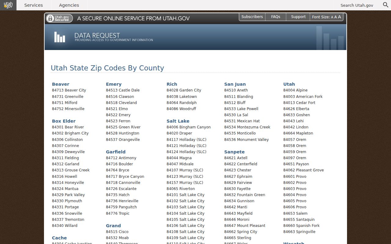
The Utah ZIP data table is the source for these Weber County rows. Use it as a coverage lead, then check the address with USPS.
Weber County ZIP Code Assignment
The official USPS by-address form asks for street address, city, and state, then returns the delivery ZIP or ZIP+4. Search the complete address, keep an apartment or unit when one exists, and compare the result with county parcel GIS. Nearby city labels and a historical directory post office are useful clues, but they cannot replace the delivery lookup.
| Street address | Enter the complete delivery address, including unit detail when applicable. |
|---|---|
| City | Use the city or place supplied for the mailing address. |
| State | Select Utah before submitting the address. |
| Result | USPS returns the assigned ZIP or ZIP+4 for that address. |
Weber Parcel Search accepts an address but did not expose a confirmed ZIP filter during the maintenance state. Utah voter search accepts ZIP as one self-lookup field. GIS maps parcels; it does not establish postal assignment.
The USPS ZIP Code Lookup is the source behind this address-level ZIP capture.
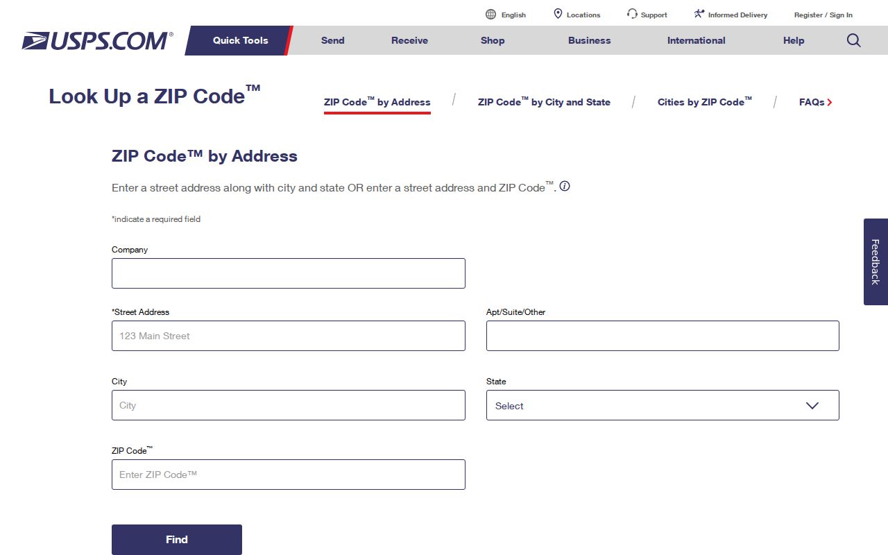
The USPS ZIP Code Lookup is the right final check for a street-level ZIP. Once the ZIP narrows the search, the Weber County street directory handles the parcel and address chain.
Finding Weber Residents by ZIP Code
A ZIP code directory cannot produce a confirmed countywide resident list because the local systems do not share one ZIP-keyed public index. Use a layered route for a lawful research question.
- Confirm the complete address and ZIP through USPS.
- Search Weber Parcel Search by address, then save the parcel or land-serial number.
- Use GIS to check the parcel, road, municipality, and nearby geography.
- Use the Utah voter form only for the registrant’s own registration and polling information.
- Ask the relevant municipal or county custodian when a permit, deed, tax, or public request is the real need.
The state’s paid voter files and election-voted reports have separate rules, fees, and date-sensitive availability. No per-ZIP Weber registration table was located. Do not infer a person’s current place from a ZIP match.
Weber County ZIP Code History
Older Weber city directories often use a post-office name, ward, or street guide instead of a modern ZIP code. A 1918 Ogden volume may identify an address by numbered street and the Wall/Washington relationship. Translate that entry through the historical guide, then test the modern parcel and map. A current ZIP should never be back-applied to an old directory page without preserving the original wording.
Rural and valley place labels such as Eden, Huntsville, and Hooper can sit within a broader county research trail. Newspapers, directories, census entries, and deeds may use different place names for the same historical household. Keep publication year and source page with each translation.
The 1918 Ogden directory item includes the street-and-avenue guide used for this kind of address normalization.
Weber County ZIP Code Geography
Postal geography, tax geography, and municipal geography answer different questions. USPS assigns delivery routes. GIS displays physical parcels and roads. The Assessor and Treasurer work with tax units. A city handles local permits and address records. The Recorder preserves the legal description. A ZIP code directory can point you toward a place, but it cannot replace any of those custodians.
- ZIP code
- A postal delivery area assigned by USPS, not a legal city or county boundary.
- ZIP+4
- The more specific nine-digit delivery code returned for some complete addresses.
- PO-box ZIP
- A postal label used for boxes or special delivery arrangements; verify its actual use with USPS.
- Unique ZIP
- A ZIP associated with a special place or institution rather than a broad neighborhood.
- Carrier route
- A delivery-route concept within postal operations, not a parcel or resident index.
No official Weber ZIP split, realignment history, complete post-office list, or ZIP-level resident table was located. The safe claim is address-specific: verify the ZIP, then verify the record with its custodian.
Weber ZIP Data Needs an As-of Date
The Utah ZIP table is a current place-row source, not a historical boundary study. Research did not locate an official Weber ZIP split or realignment history, per-ZIP registration table, complete post-office list, or confirmed parcel ZIP output. That makes the access date important. A later table may add, remove, or relabel a row without changing the historical directory page that supplied an older address.
Use a source log with the table URL, date checked, ZIP, place label, full address, USPS result, parcel ID, and municipality. If the labels disagree, preserve both and explain the conflict. Do not turn an Ogden label into a claim about an Ogden city limit, and do not treat a parcel map as USPS delivery proof.
For resident research, ZIP is a narrowing clue only. The state voter form uses ZIP with other fields for a person’s own registration. Parcel Search accepts address but did not show a confirmed ZIP field while under maintenance. A named city custodian may have the permit or local record that the county portal does not expose.
The Census QuickFacts profile is the source behind this county-context capture.
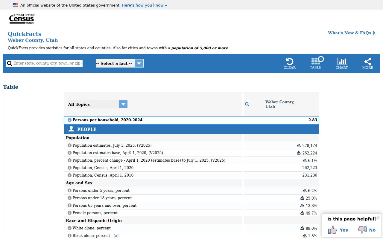
The Census QuickFacts profile adds county context, not ZIP-level resident counts. Keep population estimates separate from address research.
Weber ZIP Boundaries and City Limits
Weber County’s ZIP labels can cross a city line or use a special place name. Ogden-labeled rows do not define the municipal boundary, and a Roy, Hooper, Eden, or Huntsville label does not by itself prove the parcel’s tax jurisdiction. Hill AFB and 84201 or 84244 require address-level confirmation because the state table gives labels, not a boundary map.
- ZIP versus ZIP+4
- ZIP is the broader delivery code; ZIP+4 can narrow the destination for a complete address.
- PO-box ZIP
- A code used for postal-box or special delivery service, not proof of a home parcel.
- Unique ZIP
- A special-purpose postal code whose place label should not be read as a neighborhood boundary.
- Carrier route
- An internal delivery grouping, separate from municipal, tax, and parcel boundaries.
Note: The Utah ZIP table is a place-label list; USPS and Weber GIS are needed to resolve a real address.
The Weber County GIS page supplies parcel and map context. It does not turn a ZIP into a legal boundary or a resident directory.